Pecoy Point Preserve
Size
21.5 acres
Description
Some 1100 feet of pondshore are conserved here, as well as sloping grasslands, salt marsh and a freshwater pond. It is a pocket of pastoral land in an otherwise suburbanized area. Notable here are the short-distance views of Felix Neck on the opposite shore of Majors Cove, the long-distance views of Cape Poge and the thick patch of switchgrass near the water’s edge. Rare plants include eastern gama-grass, whose spreading the land bank is seeking to encourage via proximate patch mowing.
Universal Access
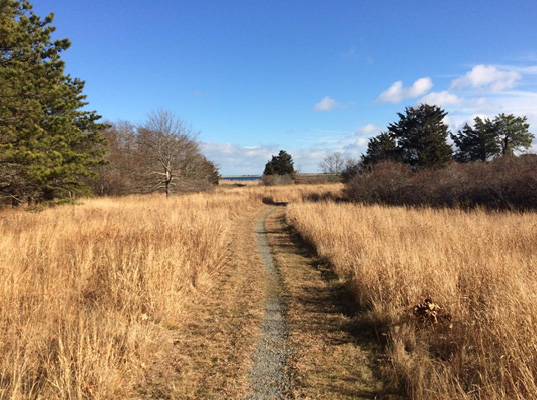
- Difficulty rating: Moderate
- Trail: 1,000’ of hardened trail and 150’ of raised boardwalk
- Points of Interest: Views of old farmfield, salt marsh, small pond, and Sengekontacket Pond
- Benches: 1
Access
Begin where the County Road meets the Edgartown - Vineyard Haven Road. Travel 0.9 miles on the County Road and turn right onto the Pulpit Rock Road. Two dirt roads are located on the right 0.3 miles down this road; turn into the second road, which is marked by a land bank logo sign. Trailhead and bicycle rack are located at the end of this road.
Historical Highlights
- the name Pecoy is derived from the Algonquin word “pohqu-auk” which means “open land” or “land naturally fit and clear for cultivation”
- Pecoy Point was part of the 200-acre Norton farm for the next 240 years and six generations of Nortons
